


Measured Building Surveys in Bromley, London & Kent
Precision Data for Architects, Developers & Homeowners
At Kelly’s Chartered Building Surveyors, we combine years of specialist experience with the latest technology to provide accurate measured surveys for all types of buildings and land.
Whether you need a simple residential floor plan or a complex structural survey of a tunnel or culvert, we deliver the precise data you need to move your project forward.
From our head office in Bromley, we serve residential and commercial clients across London, Kent, and Sussex.
Why Choose a Chartered Building Surveyor?
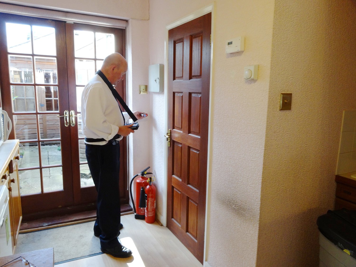
Unlike standard CAD technicians, our team consists of experienced RICS Chartered Building Surveyors. This means we look at your building through an expert lens. We do not just capture dimensions; we understand building pathology, construction methods, and architectural nuances.
Our expertise extends to any type of building or structure, both above and below ground. We have the technical capability to map complex and confined spaces, including:
- Residential & Commercial Properties
- Heritage & Listed Buildings
- Below-Ground Structures (Basements, Tunnels, and Culverts)
- Industrial Sites & Land
Advanced Surveying Technology
We have moved far beyond the tape measure, investing in the latest computer technology to carry out surveys with forensic accuracy.
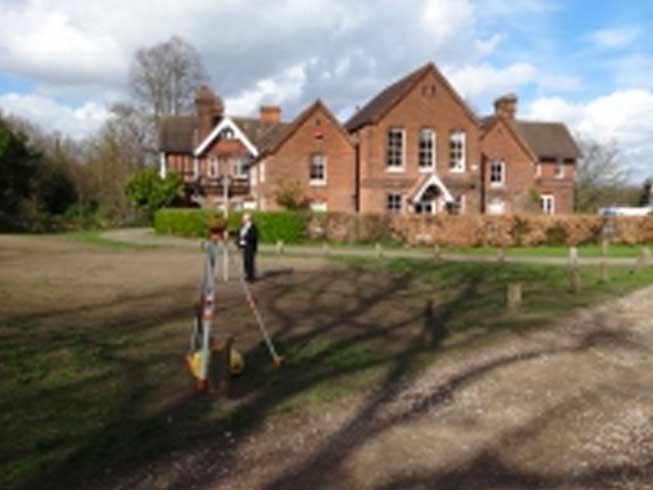
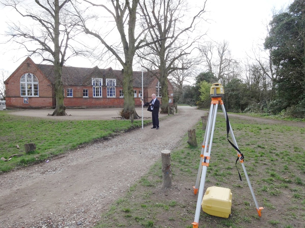
- Laser Precision: Our surveyors use advanced laser measuring devices linked directly to our architectural software. This allows us to formulate and produce the survey drawing in real-time as it is being measured on-site. By capturing data digitally from the moment we arrive, we eliminate human error and ensure every dimension is verified before we leave the property.

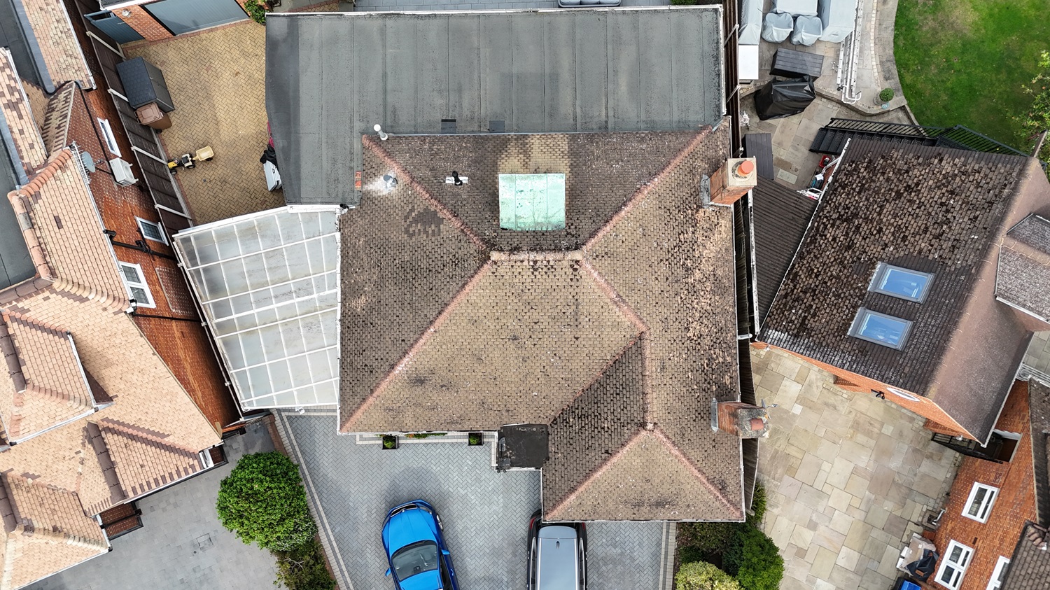
- Drone Integration: For external areas, we combine our internal laser precision with 4K Drone Technology to safely map roofs and boundaries that are difficult to access from the ground.
- BIM-Compatible CAD Outputs: We utilise Drawing Express to produce highly accurate, meticulously drafted 2D CAD drawings. These act as the perfect foundational layers for architects and engineers to import into their 3D Building Information Modelling (BIM) workflows.
Comprehensive Survey Services
We provide a full range of survey formats tailored to your specific requirements. Our core services include:
Architectural Drawings
- Floor Plans & Elevations: Detailed layouts and highly accurate exterior facades for space planning, interior design and planning applications.
- Cross-Sections: Vertical slices through the building illustrating structural floor thicknesses, changes in floor levels and stair profiles.
- Roof Details: Detailed layouts of roof structures and external site features mapped via our drone and laser technology
Specialist & Legal Plans
- Lease Plans: Land Registry-compliant drawings for commercial and residential leases.
- Land Registry Title Plans: Carrying out precise alterations and updates to existing land registry title plans.
- Office Floor Plans: Accurate Net Internal Area (NIA) calculations for commercial agents and tenants.
- Home Owner’s Plans: Simplified residential floor plans ideal for property sales or early-stage renovation concepts
Verification Services
- As-Built Floor Plans: Verification surveys to confirm that completed construction accurately matches the original design.
- Checking Existing Drawings: We can audit and verify third-party plans to ensure they are 100% accurate before you begin building.
Deliverables & Formats
Flexibility is key. We provide your survey information in the exact formats required to suit your, or your architect's, workflow:
- Digital Formats: .DWG, .DXF, and PDF (fully compatible with AutoCAD, BIM software, and standard PDF viewers).
- Transfer Methods: Files can be delivered via Email, USB Memory Stick, or a Secure Cloud Download link.
- Paper Copies: Scalable, high-quality hard copies are available upon request.
Local Expertise: Areas We Cover
We are proud to be local experts based in Bromley, serving the entire borough (including Orpington, Chislehurst, and Beckenham). From historic Victorian properties in Central London to modern commercial units in Kent and rural estates in Sussex, we understand the local architectural landscape and planning requirements.
Frequently Asked Questions (FAQs)
What is a measured survey?
A measured survey involves taking highly accurate physical measurements of a building or site to produce scaled drawings. These are essential for architects, engineers and planners when designing extensions or refurbishments, or applying for planning permission.
Why should I use Kelly's Chartered Surveyors?
As RICS Chartered Building Surveyors, we bring a deep understanding of building pathology to every survey. Furthermore, our real-time, on-site digital drafting ensures that we capture and verify every structural nuance before we even leave your property, preventing costly redesigns later.
How long does a measured building survey take?
The time spent on-site depends entirely on the size and complexity of the property. A standard residential home in Bromley might take half a day to a full day, whereas mapping a complex commercial basement or culvert will take longer. We will always provide a clear timeline when we quote your project.
How much does a measured survey cost?
Because every property is unique, we price our measured surveys on a project-by-project basis. Costs are influenced by the size of the building, the level of detail required and the location.
Free Initial Advice
If you have any Measured Survey requirements, please contact us for free initial advice. We are happy to discuss your specific needs, whether it’s a single house or a complex underground structure, and will provide a competitive, fixed-fee quote.